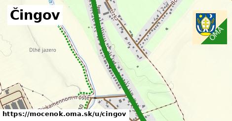
čísla, 1 z 4
19 ¤,
26 ¤,
32 ¤,
83 ¤,
1 ¤,
10 ¤,
100 ¤,
101 ¤,
102 ¤,
103 ¤,
104 ¤,
105 ¤,
106 ¤,
108 ¤,
11 ¤,
110 ¤,
112 ¤,
116 ¤,
11A ¤,
12 ¤,
120 ¤,
13 ¤,
132 ¤,
134 ¤,
136 ¤,
138 ¤,
14 ¤čísla, 2 z 4
140 ¤,
142 ¤,
144 ¤,
15 ¤,
16 ¤,
18 ¤,
2 ¤,
20 ¤,
21 ¤,
22 ¤,
23 ¤,
24 ¤,
25 ¤,
27 ¤,
28 ¤,
29 ¤,
3 ¤,
30 ¤,
31 ¤,
33 ¤,
35 ¤,
37 ¤,
38 ¤,
39 ¤,
4 ¤,
41 ¤,
42 ¤čísla, 3 z 4
43 ¤,
44 ¤,
47 ¤,
48 ¤,
49 ¤,
5 ¤,
51 ¤,
52 ¤,
53 ¤,
54 ¤,
55 ¤,
56 ¤,
57 ¤,
58 ¤,
59 ¤,
6 ¤,
60 ¤,
61 ¤,
62 ¤,
63 ¤,
64 ¤,
65 ¤,
66 ¤,
67 ¤,
68 ¤,
69 ¤,
7 ¤čísla, 4 z 4
70 ¤,
71 ¤,
72 ¤,
73 ¤,
75 ¤,
76 ¤,
77 ¤,
78 ¤,
79 ¤,
8 ¤,
80 ¤,
81 ¤,
82 ¤,
84 ¤,
85 ¤,
86 ¤,
88 ¤,
89 ¤,
9 ¤,
90 ¤,
91 ¤,
92 ¤,
93 ¤,
94 ¤,
95 ¤,
97 ¤,
99 ¤MHD na ulici
Šaľa-Šoporňa-Sereď spoj: 2 ¤ ,
Šaľa-Šoporňa-Sereď spoj: 66 ¤ ,
Šaľa-Šoporňa-Sereď spoj: 46 ¤ ,
Šaľa-Šoporňa-Sereď spoj: 38 ¤ ,
Šaľa-Šoporňa-Sereď spoj: 20, 52, 14 ¤ ,
Šaľa-Šoporňa-Sereď spoj: 32, 34 ¤ ,
Šaľa-Šoporňa-Sereď spoj: 22, 30, 50, 58, 70, 4 ¤ ,
Šaľa-Šoporňa-Sereď spoj: 64 ¤ ,
Šaľa-Šoporňa-Sereď spoj: 8,28,40,56 ¤ ,
Šaľa-Šoporňa-Sereď spoj: 12 ¤ ,
Šaľa-Šoporňa-Sereď spoj: 18,26,54 ¤ ,
Šaľa-Šoporňa-Sereď spoj: 13,1,55,45,59,69 ¤ ,
Šaľa-Šoporňa-Sereď spoj: 17 ¤ ,
Šaľa-Šoporňa-Sereď spoj: 21,31,33,43,49 ¤ ,
Šaľa-Šoporňa-Sereď spoj: 25,7 ¤ ,
Šaľa-Šoporňa-Sereď spoj: 27,29 ¤ ,
Šaľa-Šoporňa-Sereď spoj: 5 ¤ ,
Šaľa-Šoporňa-Sereď spoj: 63 ¤ ,
Šaľa-Šoporňa-Sereď spoj: 37 ¤ ,
Šaľa-Šoporňa-Sereď spoj: 67 ¤ ,
Šaľa-Šoporňa-Sereď spoj: 15 ¤ ,
Šaľa-Šoporňa-Sereď spoj: 41,39 ¤ ,
Šaľa-Šoporňa-Sereď spoj: 35 ¤ Viac
Viac info:
aktualizovať mapu,
uprav v JOSM (pokročilé),
562432477,
stiahni GPX, oblast id: 2210564, dlzka: 1247, oblast name: Močenok, oblast asci: mocenok, psc: {95131}, obce:
Slovensko,
Západné Slovensko,
Podunajská nížina,
Trnavská pahorkatina,
Nitriansky kraj,
Nitrianska pahorkatina,
okres Šaľa,
Močenok, lon: 17.933033689096636, lat: 48.21500743152878, bus bay: right, old ref: 508011, abutters: residential, source:ref: www.ssc.sk, osm version: 1, osm changeset: 0, osm timestamp: 2026 03 07T08:41:57Z, sidewalk:both: separate, sidewalk:left: no, sidewalk:right: separate,
Zdroj dát
Mapové údaje pochádzajú z
www.OpenStreetMap.org, databáza je prístupná pod licenciou
ODbL.

Mapový podklad vytvára a aktualizuje
Freemap Slovakia (www.freemap.sk), šíriteľný pod licenciou CC-BY-SA. Fotky sme čerpali z galérie portálu freemap.sk, autori fotiek sú uvedení pri jednotlivých fotkách a sú šíriteľné pod licenciou CC a z wikipédie. Výškový profil trás čerpáme z
SRTM. Niečo vám chýba?
Pridajte to. Sme radi, že tvoríte slobodnú wiki mapu sveta.